Our Services
Unlock the gateway to unparalleled civil engineering solutions by reserving an appointment with our distinguished experts. Experience the pinnacle of innovation and quality in every consultation tailored exclusively to your project's unique vision.

Property survey
These surveys are crucial for real estate transactions, land development, and resolving boundary disputes. They provide a clear and accurate understanding of a property's dimensions and legal limits. Let me know if you'd like more details about its process or types!

Title Survey
A title survey combines a property survey with a review of legal documents to establish the boundaries, features, and ownership details of a property. It identifies any encroachments, easements, or rights of way and ensures that the property complies with local laws and title requirements. Title surveys are essential for real estate transactions and provide both physical and legal clarity about a property. Let me know if you'd like further insights!

alta survey
An ALTA survey, or American Land Title Association survey, is a detailed property survey conducted to meet specific standards established by ALTA and the National Society of Professional Surveyors (NSPS). It provides comprehensive information about boundaries, easements, encroachments, improvements, and other critical features affecting the ownership or use of the land. ALTA surveys are often required for commercial real estate transactions to ensure accuracy and legal compliance.

architectural survey
Architectural surveys are essential for creating accurate plans, ensuring compliance with building codes, and preserving heritage structures. They provide the foundational data needed for thoughtful and efficient architectural design.
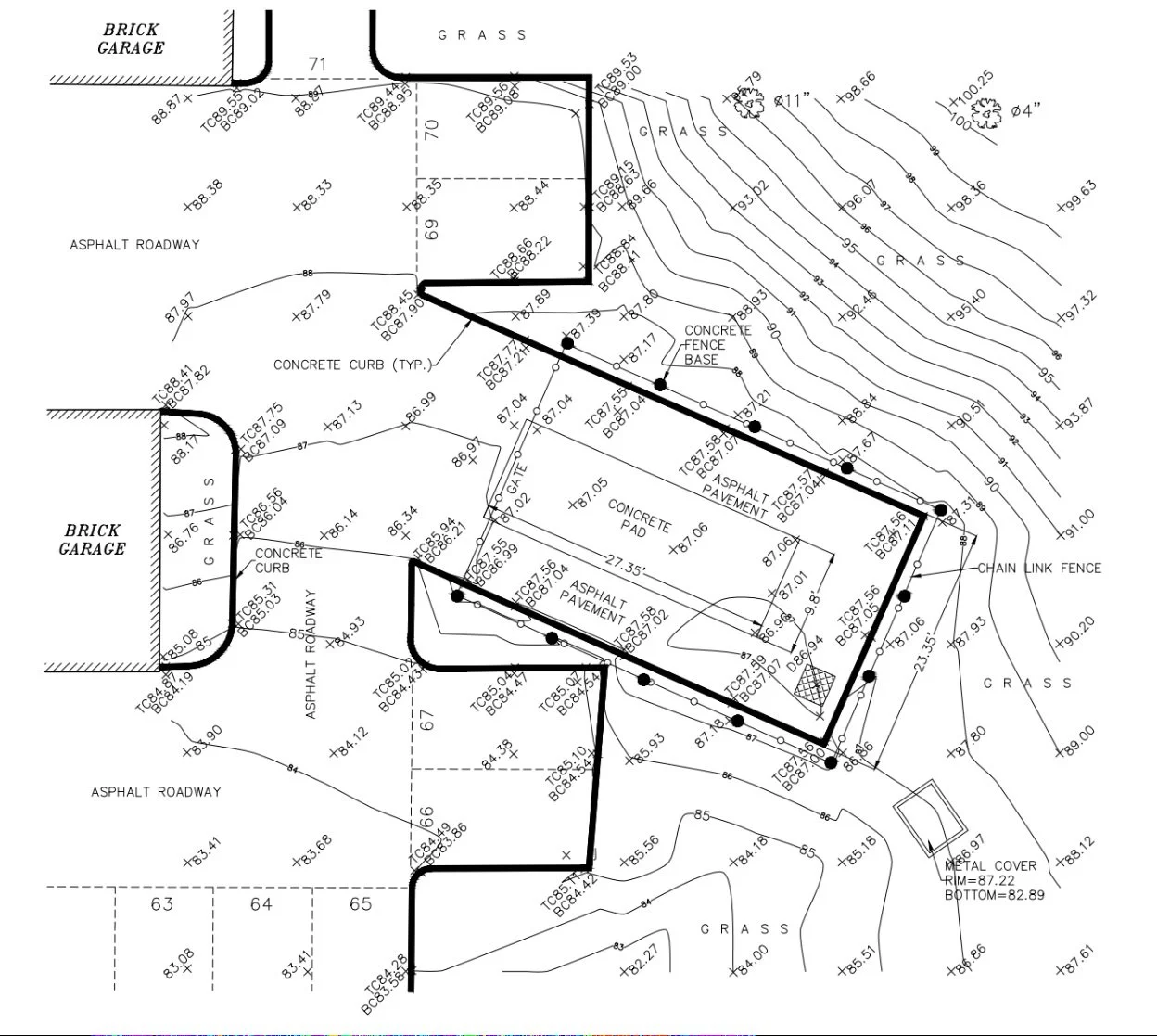
Topographical survey
Topographical surveys are critical for various industries, including construction, engineering, environmental planning, and land development. They help in assessing the terrain for design, planning, and execution, ensuring that projects are compatible with the existing landscape. These surveys also play a key role in legal documentation, land disputes, and resource management.
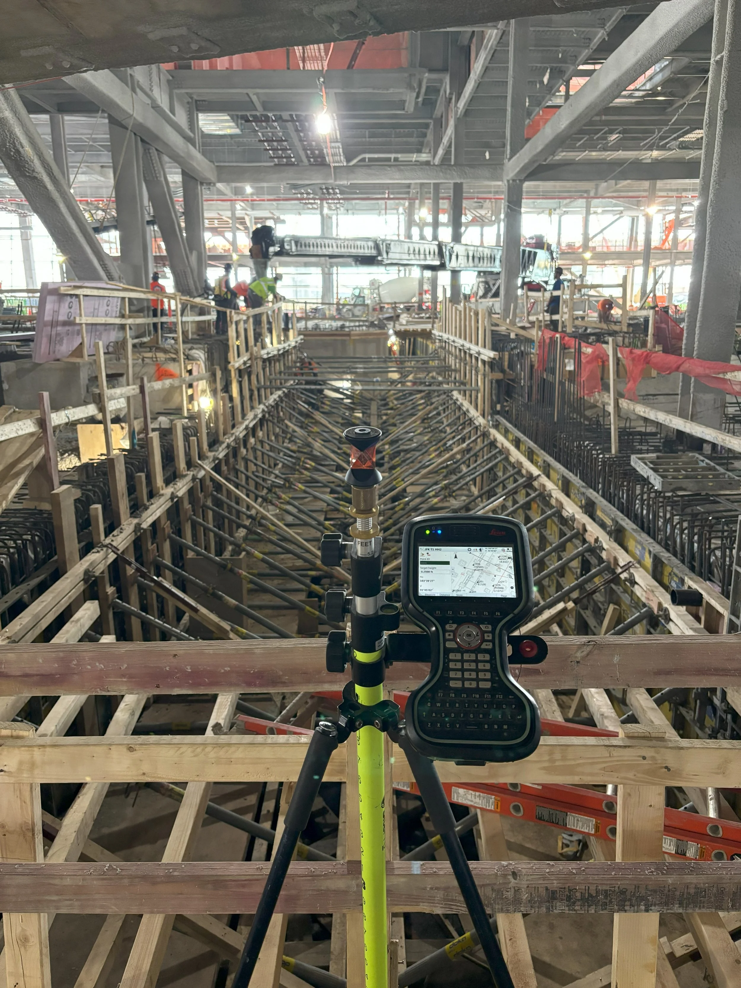
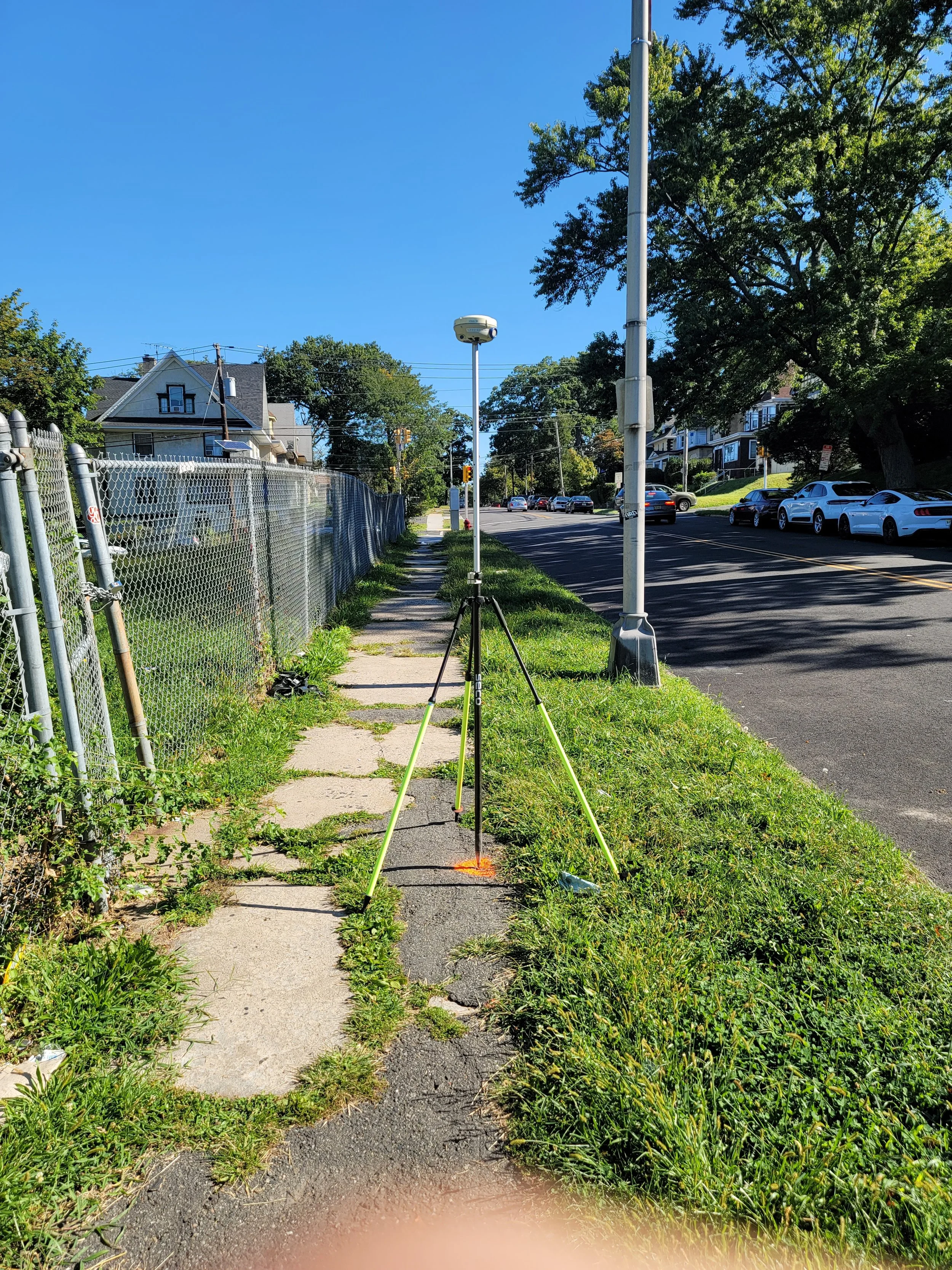
construction services
Construction surveying services involve the precise measurement, mapping, and layout of a construction site to guide the building process. These services ensure that structures are accurately positioned according to design plans, accounting for boundaries, elevations, and angles. Surveyors provide critical data for grading, foundation placement, utility installation, and alignment of roads or buildings.
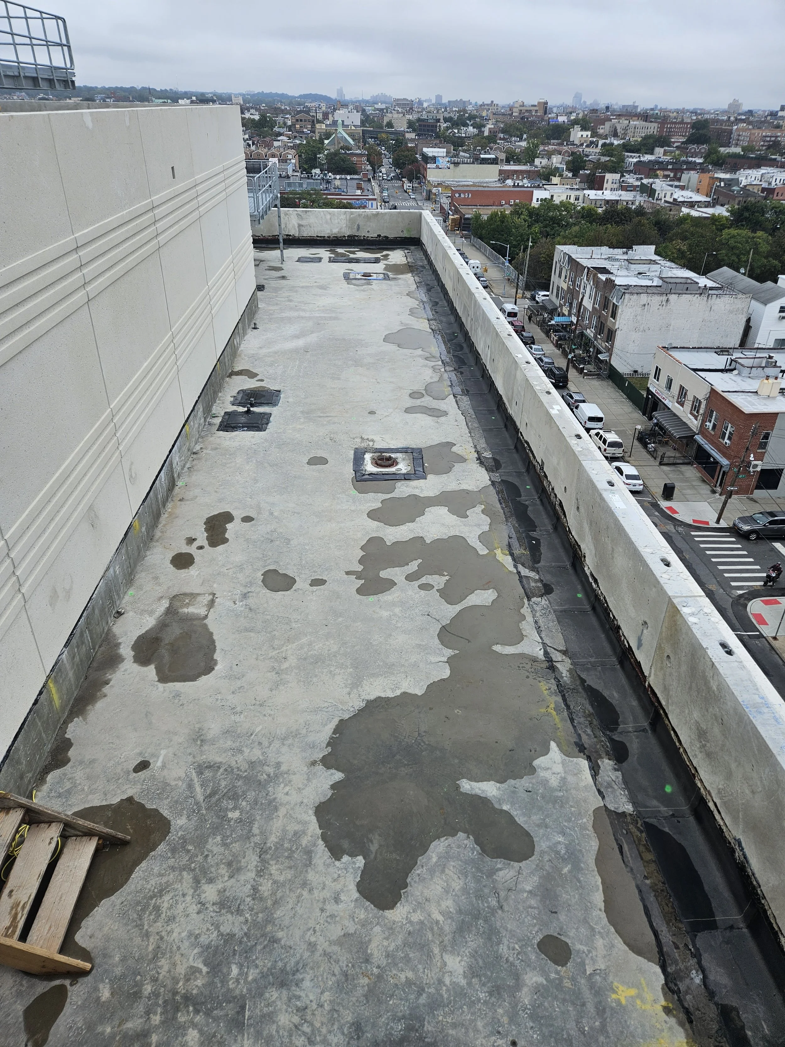
roof survey
A roof survey involves assessing the details of a roof by measuring existing top-of-insulation elevations, concrete deck or screed elevations, drain locations and elevations, parapets, and scuppers. Additionally, it includes calculating proposed insulation elevations to meet the minimum slope requirements specified in the project specifications. This ensures proper drainage, structural integrity, and compliance with design standards. Let me know if you'd like further details!
The F1A and 2C certificates likely pertain to specific types of land or building surveys required for compliance with local regulations, zoning, or construction standards. While the exact details of these certificates may vary depending on the jurisdiction, they typically document critical information such as property boundaries, elevations, or structural assessments. These certificates are often used to support legal documentation, development projects, or regulatory approvals.
f1a & 2c certificates
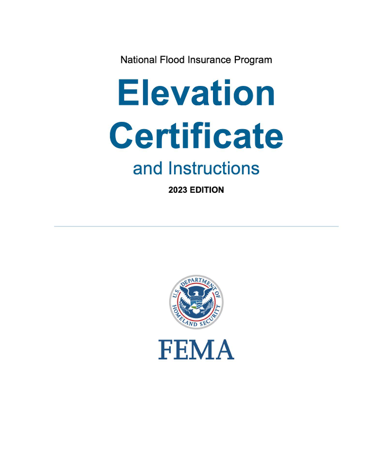
elevation certificate
A FEMA Elevation Certificate is an official document used to provide elevation information about a property in relation to the base flood elevation (BFE). It is often required for properties located in flood-prone areas to determine flood insurance premiums, ensure compliance with local floodplain management regulations, and verify building elevations for safety. The certificate includes details such as property location, flood zone, building characteristics, and elevation data.

WELLS MONITORING
A monitoring wells survey consists of horizontal and vertical measurements of specialized wells that collect groundwater samples and assess subsurface conditions. These wells help monitor water quality, detect contaminants, measure groundwater levels, and understand the movement of pollutants or natural flow patterns. It's a vital tool in environmental studies and site assessments, ensuring better management of water resources and contamination remediation.

LiDAR (Light Detection and Ranging) 3D scanning in land surveying uses laser pulses to create precise and detailed maps of terrain and structures. The technology measures distances by analyzing the time it takes for laser beams to bounce back from the surface. It helps surveyors capture elevation data, identify features, and generate 3D models of the landscape with incredible accuracy, even in challenging or inaccessible areas. It's particularly valuable for large-scale projects like topographic surveys, urban planning, environmental assessments and construction.
3d scanning
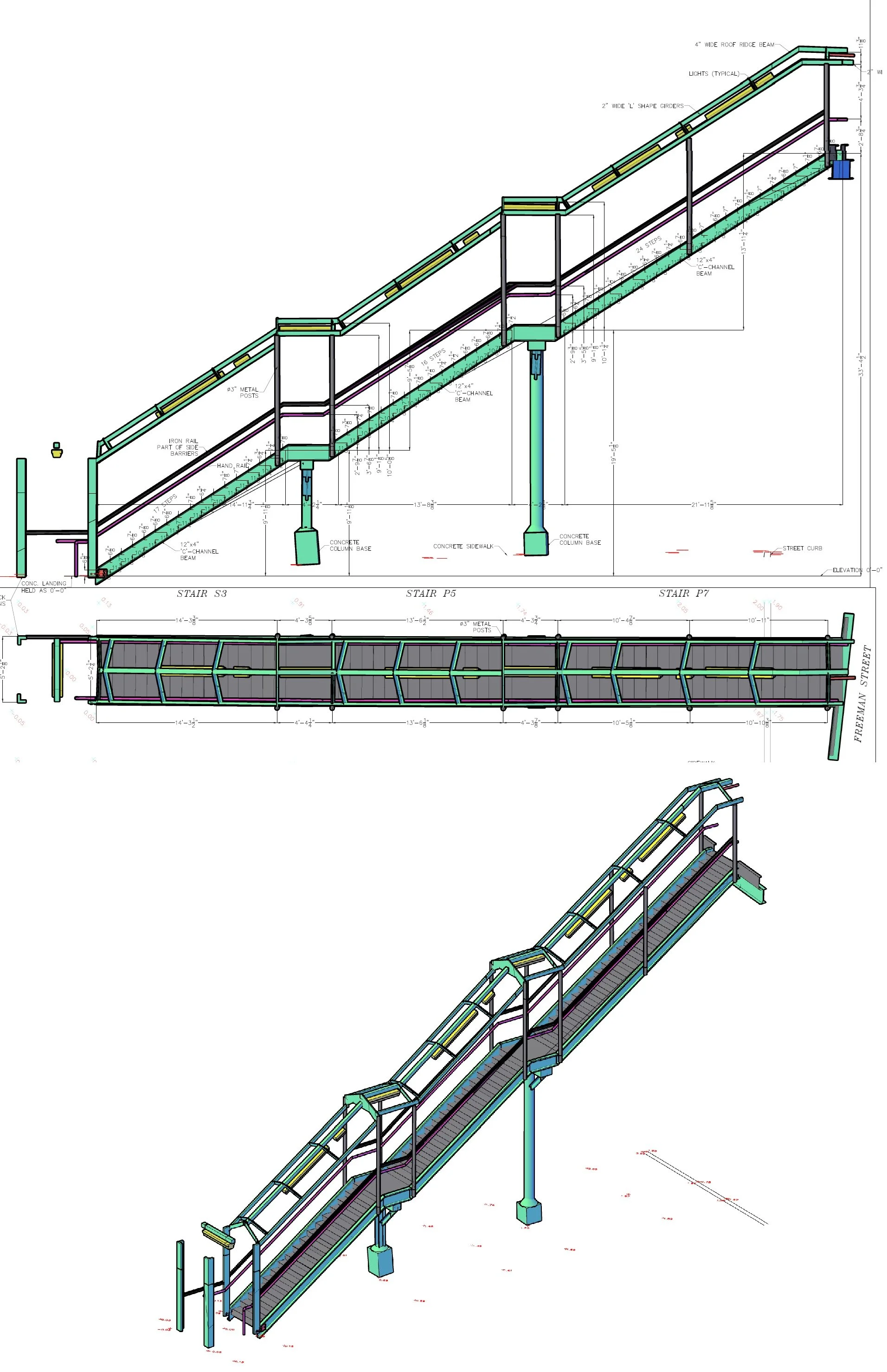
mta stations
Land surveys for MTA stations typically involve precise measurements and mapping of the area surrounding transit stations as well as pre-construction conditions and details. These surveys help in planning construction, ensuring accessibility, and integrating station entrances with the surrounding urban environment.

SOLAR PANEL PERMITS
At Robust Land Surveying, we specialize in providing precise and reliable land surveying services tailored for solar panel installation projects. Whether for residential, commercial, or utility-scale systems, our surveys support engineers, contractors, and property owners in meeting all permitting requirements efficiently and accurately.
Our experienced team works closely with solar companies, architects, and local municipalities to deliver the surveys required to obtain building and electrical permits for rooftop or ground-mounted solar installations.

sca projects
We are proud to be actively involved in SCA (School Construction Authority) projects across all boroughs, delivering exceptional land surveying services. Our commitment to precision, reliability, and excellence ensures the highest quality results for every project, contributing to the development and improvement of educational facilities throughout the region.

union projects
Our team comprises highly trained and skilled union employees who are equipped to handle even the most demanding projects. With extensive expertise, professionalism, and dedication, we ensure the highest standards of quality and efficiency, no matter the challenge.
Contact us
Interested in working together? Fill out some info and we will be in touch shortly. We can’t wait to hear from you!